Remote sensing detects irrigation non-compliance

Remote sensing detects irrigation non-compliance
- July 5, 2021
- JCRMO
- Blog
- No Comments
Remote sensing-based tools help effectively control illegal water uses. Irrigation non-compliance is becoming a more and more serious issue with increased droughts and changing climate. With these techniques, you can locate irrigated areas without concession and excesses of the authorised volume.
A Case Study in Spain
Because of its scarcity, irrigation water use in La Mancha Oriental (Spain) is regulated by strict rules:
- Water is a public good, any use requires authorization from the Júcar Hydrographic Confederation (CHJ).
- There is no water market. The Central Irrigation Board grants water concessions to specific areas.
- For each irrigation campaign, the Central Irrigation Board of La Mancha Oriental (JCRMO) and the CHJ approve a rule limiting the use of concessions.
Irrigation non-compliance mainly occurs:
- Applying water to unauthorised surfaces.
- Using more volume than authorised.
Why is it important to control water use defaulters?
There are a small number of users who do not respect the rules but can cause distrust in the system and general uncontrollability in water use. As the saying goes; One rotten apple can spoil the whole bunch. Aircraft and drones cannot currently economically locating these violations, because there are thousands of wells in the vast expanse of land in La Mancha Oriental (9,962 km2).
The ERMOT and the DIANA projects have provided water managers with robust, remote sensing-based tools to locate potential defaulters.

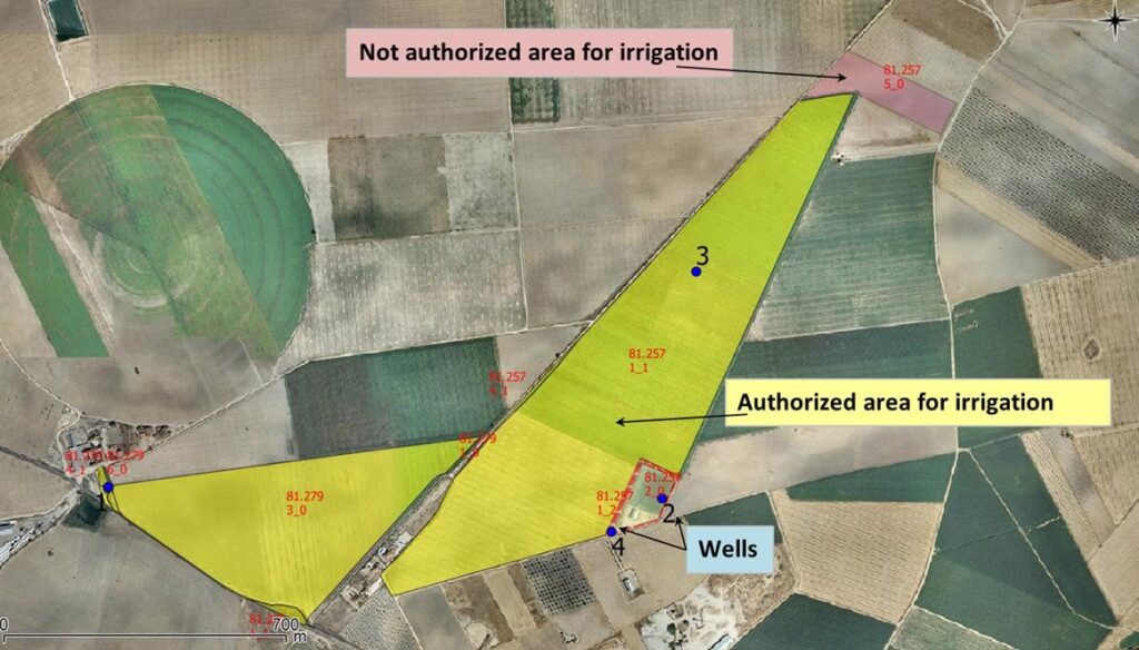
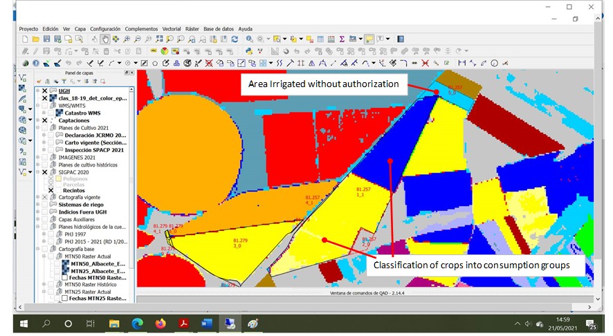
Unauthorized surface control
The geographic information system shared between water users and the Júcar Hydrographic Confederation provides the layer of those areas that have irrigation authorisation. Remote sensing indicates surfaces that are compatible with irrigation water use. The crossing of both layers locates the points where the field inspection has to be directed. The inspector checks for illegal irrigation and proceeds to sanction.
Water overuse control
Remote sensing allows farmers to obtain information about the quantity, quality and development of vegetation in a plot. You can express these factors in a vegetation index (NDVI) that is directly related to water consumption.
For each farm, water consumption can be estimated and compared with the volume authorized for watering. If the farmer exceeds this volume, the inspector checks the crops and water meters in the field and proceeds to sanction.
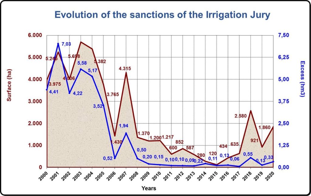
But, what are the results?
The effectiveness of the control system has allowed the number of non-compliance with the rules to be low. The volume of illegal irrigation water used represents less than 1% of all uses in La Mancha Oriental.
Benefits
Control of non-compliance with the rules for the use of irrigation water is essential to avoid overexploitation of water bodies. In the case of La Mancha Oriental (Spain), the ERMOT and DIANA projects have provided water managers with tools to locate defaulters. The information provided by earth observation is inexpensive and highly effective in controlling water uses.