
agriculture
Sentinel-2 satellites map crop-water use over Aussie farms
- February 8, 2022
- University of Melbourne
- Blog
- No Comments
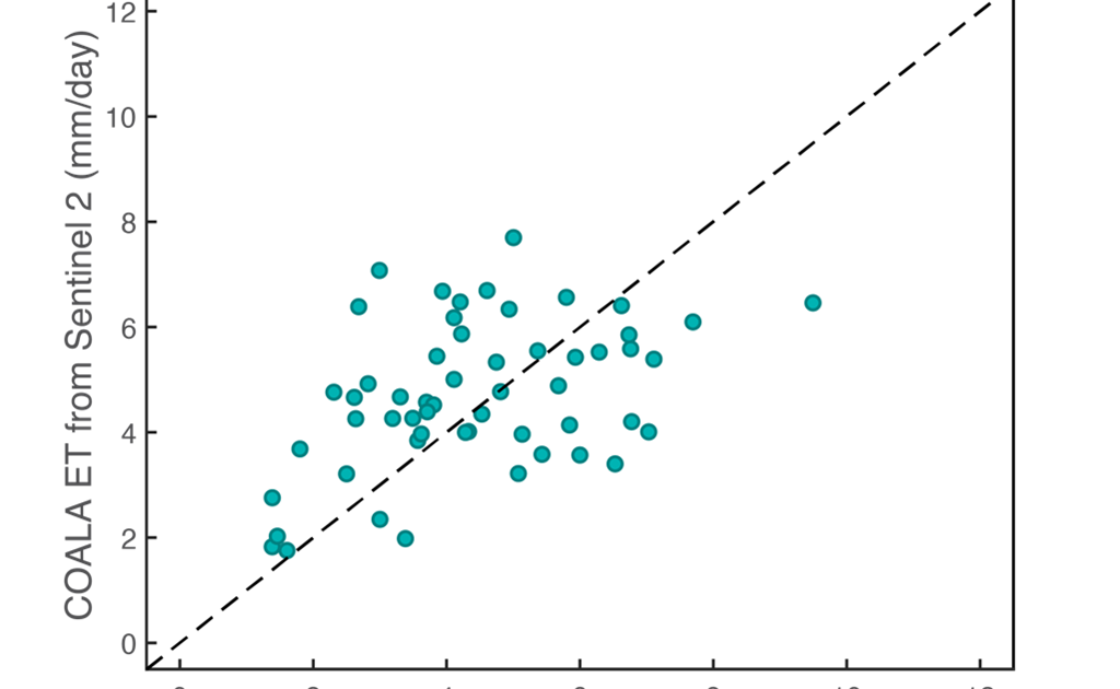
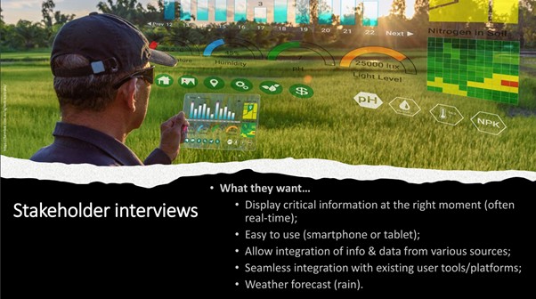
European Union’s Horizon 2020-funded international project, called COALA, produced a suite of crop growth, health and water use information. We compiled this information using high-resolution multispectral images collected from space by the Sentinel-2 satellites. The data we used was collected over irrigated cropping fields in the Goulburn Valley, Victoria during the 2020-2021 summer growing season….
Earth Observation Road Map Part 2
- February 1, 2022
- UNSW
- Blog
- No Comments
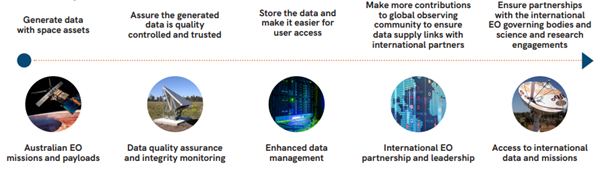
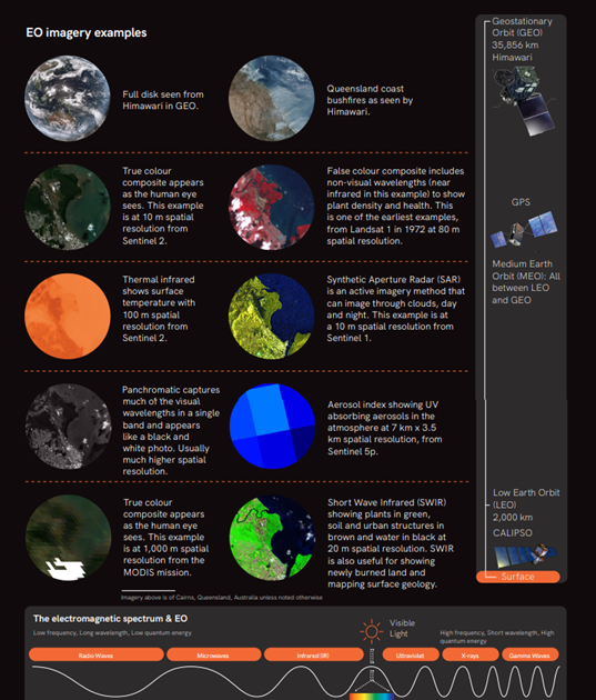
Our blog last week focused on the Australian Space Agency’s roadmap for Earth Observation (EO). We first discussed how Earth observation helps Australia’s economy (even in fields you wouldn’t expect). Then we talked about the priority areas that were identified by the Space Agency. This week we are summarising the five key areas that the…
The Australian Earth Observation from Space Roadmap
- January 25, 2022
- UNSW
- Blog
- No Comments
What are the goals of the Australian Earth Observation from Space roadmap and how it can benefit from international collaborations like the COALA project? Late last year, the Australian Space Agency released its Earth Observation from Space roadmap for 2021-2030. This roadmap highlights that many sectors of the Australian economy and society, ranging from agriculture,…
The effect of a global pandemic on an international project
- November 15, 2021
- BCG
- Blog
- No Comments
There are always challenges when working on a new project but throw in international partners and a global pandemic, and you would be right in thinking that such a project would be set up for failure. Fortunately, despite the challenges presented, the committed COALA project team has proved dynamic in their approach and propelled the…

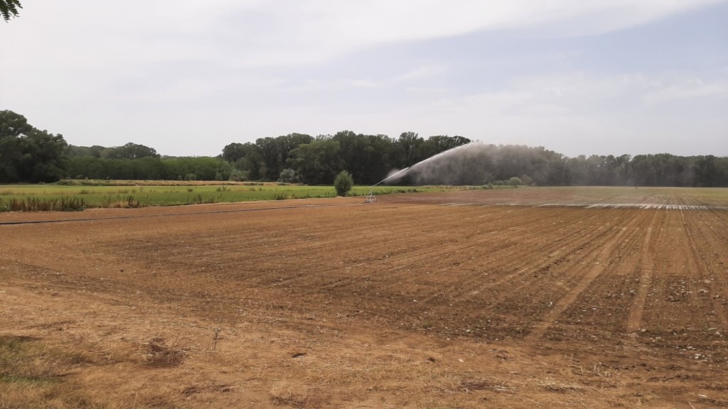
Regulating water use in woody crops with Remote Sensing
- November 4, 2021
- JCRMO
- Blog
- No Comments
How much should I irrigate? When should I irrigate? These are vital decisions that irrigators need to make daily. Some use scheduling programs. Others manually read soil moisture sensors. Others make decisions based on water district schedules. And yet others rely on models that are supported by Earth Observation (EO) satellites. Remote sensing tools can…
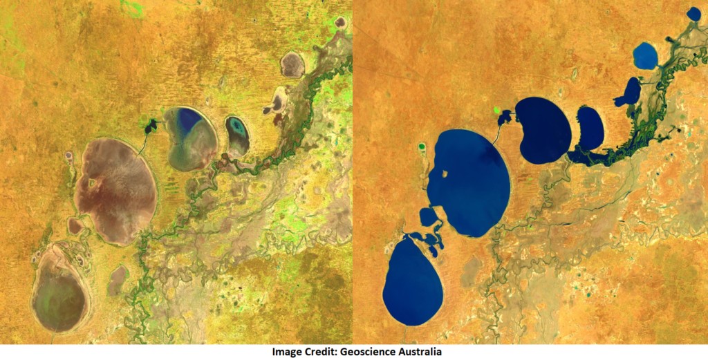
Satellites Detect Environmental Change
- September 8, 2021
- UNSW
- Blog
- No Comments
Every year in August Australian National ‘Science Week’ takes place. During National Science Week hundreds of events take place around the country. These events help engage people with science and give scientists a chance to showcase their research. One of our goals in the COALA Project is to support and focus on legacy, which so…
The COALA H2020 project: A WOMEESA seminar
- July 13, 2021
- UNSW
- Blog
- No Comments
COALA H2020 has shown us many challenges of implementation under COVID and multi-sectoral, international collaborations. WOMEESA is a network of women working in Earth and Environmental Sciences in academia, industry and government. WOMEESA works to promote Earth and Environmental Science research and activities through social networks and the media. COALA H2020 uses Earth Observation technologies…

Remote sensing detects irrigation non-compliance
- July 5, 2021
- JCRMO
- Blog
- No Comments
Remote sensing-based tools help effectively control illegal water uses. Irrigation non-compliance is becoming a more and more serious issue with increased droughts and changing climate. With these techniques, you can locate irrigated areas without concession and excesses of the authorised volume. A Case Study in Spain Because of its scarcity, irrigation water use in La…
COALA addresses new challenges in precision irrigation
- June 30, 2021
- Ariespace
- Blog
- No Comments
The COALA project has been operational since January 2020. Our project uses information provided by satellites (the Sentinels) to help support Australian farmers in the Murray-Darling Basin. One of the ways that we support farmers is through precision irrigation. Precision irrigation is a farm management approach that involves using technology to make informed decisions. The…
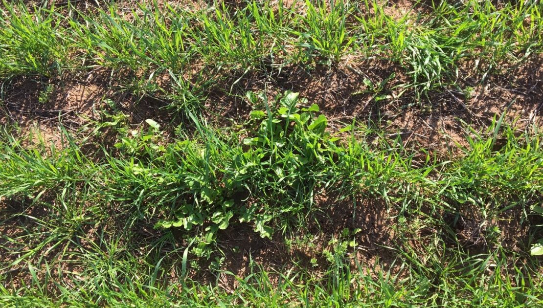
Dryland crop management supported by COALA products
- June 27, 2021
- Agrisat
- Blog
- No Comments
Two of the COALA project partners have been working throughout this past 2020 campaign to assist in managing dryland crops. Now, AgriSat and UCLM have generated satellite-derived COALA products to assist in dryland crop management in the Mallee and Wimmera regions of Victoria, Australia. The products have been generated for farms owned by BCG members….