
coala project
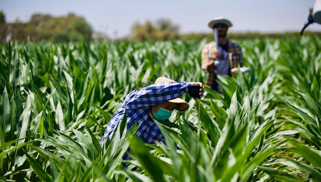
Australian farmers working with new EO services
- June 9, 2021
- BCG
- Blog
- No Comments
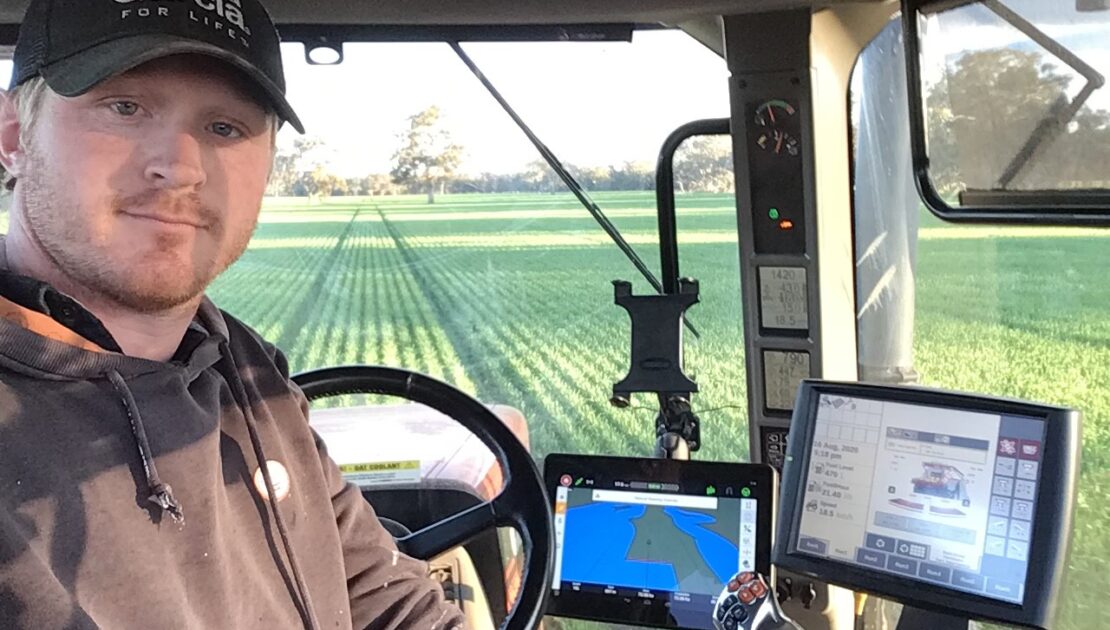
Australian farmers are working with new Earth Observation (EO) services. And, we are excited to be working with them. The COALA team is halfway through a three-year project looking at introducing new services to support more sustainable water and nutrients in Australia. We have developed relationships with several innovative Australian farmers to help with product…
Gilgai soil structure impact on crop canopy
- May 28, 2021
- University of Castilla La Mancha
- Blog
- No Comments
The COALA project The COALA H2020 project is contributing to better agriculture. COALA is implementing tools capable of determining the water and nutrient requirements of crops in space and time. These tools allow farmers to adjust the adequate supply of these resources to optimise yield. These tools are developed using a time series of images…
Curating a COALA data centre in earth observation.
- May 13, 2021
- Universität für Bodenkultur Wien
- Blog
- No Comments
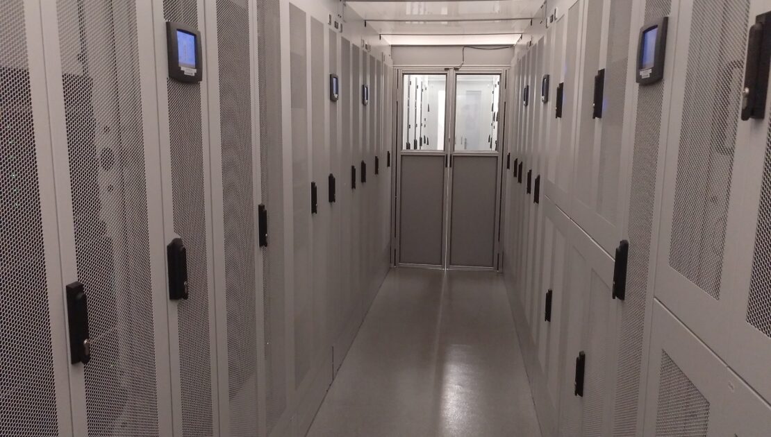
The curation of a COALA data centre is essential as access to information in real-time (or as close to as possible) is very high on the wish list of farmers and agricultural practitioners. Agriculturalists are looking for more efficient and effective ways to manage nutrients and water in their paddocks. In the first year of the…
The COALA Project: Who, What, Where and Why
- April 12, 2021
- UNSW
- Blog
- No Comments
The COALA project is developing Copernicus-based services for… supporting more sustainable use of water and nutrients in the advanced agricultural systems of Australia. sharing knowledge and expertise in the field of EO-based applications for agriculture with Australian institutions It will be a facilitator of new business experience between Europe and Australia The COALA project will…
COALA Airborne Campaigns over Farmlands in Victoria
- March 26, 2021
- University of Melbourne
- Blog
- No Comments
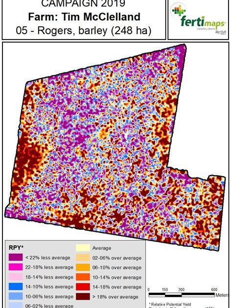
COALA airborne campaigns act in developing agricultural decision support for Australian farmers COALA offers a range of information to support irrigation and fertilisation management decisions using Sentinel-2 satellite data. Australian farmers’ input costs include a significant amount of water and fertilisers. Their optimal use has critical implications to various ecosystems that are sensitively influenced by…
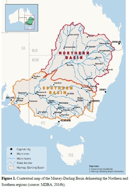
Australia’s Food Bowl – The Murray-Darling Basin
- February 15, 2021
- UNSW
- Blog
- 1 Comment
The Murray-Darling Basin (MBD) is a river system that covers 14% of the land in Australia. 70% of Australia’s agricultural water use comes from the MDB and it provides one third of Australia’s food supply. Which is how the basin earned its nickname Australia’s Food Bowl. The MDB extends across four states and one territory,…
Water managers sharing experience is key to success.
- February 8, 2021
- ANBI Campania
- Blog
- No Comments
Role of ANBI Campania and its contribution to the COALA project, and the need for experienced water managers ANBI Campania (Italy) is one of the two European Water User Association partners in the COALA Project. ANBI transfers its experience as a European final user of satellite-based decision support systems. This blog collects the thoughts of…
Educational Resources
- February 5, 2021
- UNSW
- Tutorial Students
- No Comments
COALA is currently working with educational providers such as the NSW Department of Education to develop educational resources about agriculture, remote sensing and earth observation. We will update this page regularly as more resources are developed.
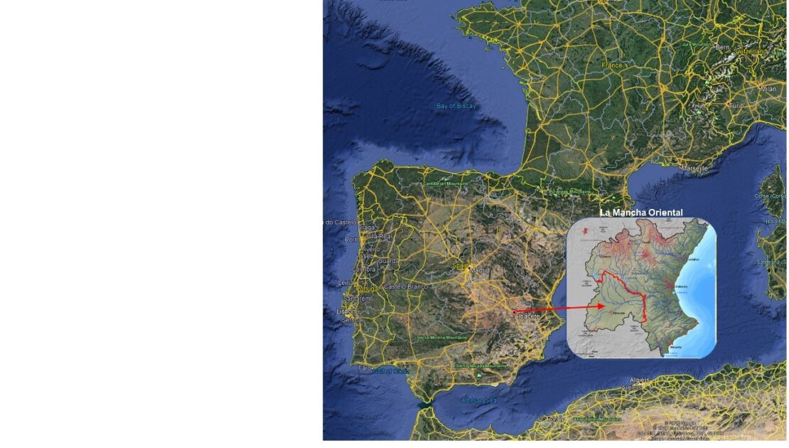
Copernicus for water management and allocation
- January 3, 2021
- JCRMO
- Blog
- No Comments
Copernicus for water management: a story of success. Earth Observation data from Copernicus optimised irrigation management in drylands of South East Spain. How it all began During a severe drought in 1995-1996, the aquifers in the region of La Mancha Oriental reached a dangerous level. So low that the Central Government of Madrid threatened to…