
Goulburn Valley
Sentinel-2 satellites map crop-water use over Aussie farms
- February 8, 2022
- University of Melbourne
- Blog
- No Comments
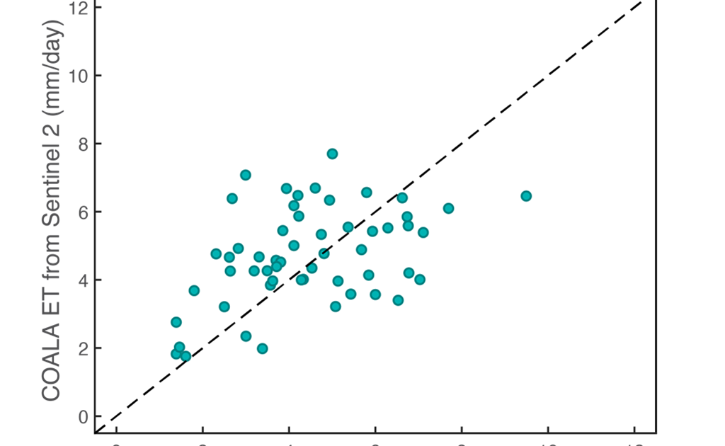
European Union’s Horizon 2020-funded international project, called COALA, produced a suite of crop growth, health and water use information. We compiled this information using high-resolution multispectral images collected from space by the Sentinel-2 satellites. The data we used was collected over irrigated cropping fields in the Goulburn Valley, Victoria during the 2020-2021 summer growing season….