Coala Project > About us > Related projects

Related Project

National or international research and innovation activities linked with the project

Partners of the COALA consortium have been involved in research and innovation EU-funded projects or commercial innovation activities related to the project objectives. In COALA the aim is to more closely implement and co-create in the Australian context, with the local partnership and expertise to introduce innovative technologies both for the farmers’ business and the water resources management.

Following table summarizes these projects and activities and explains how they will feed COALA
IRRIEYE - (2011-2015)

Schermata 2020-04-23 alle 15.34.12

IrriEye project funded South Australian Murray-Darling Basin Natural Resources Management Board.

IrriEye provides farmers and water managers of South Australian Murray Darling Basin with real-time irrigation water needs from irrigation unit to river basin scale.

This project feed to Coala Operative tools for estimating crop water requirement of fruit trees

ARIES was responsible for the design and the development of all Technical activities

Link to the project

University of Sydney Environmental Trust (2016 - 2017)

Schermata 2020-04-23 alle 14.28.39

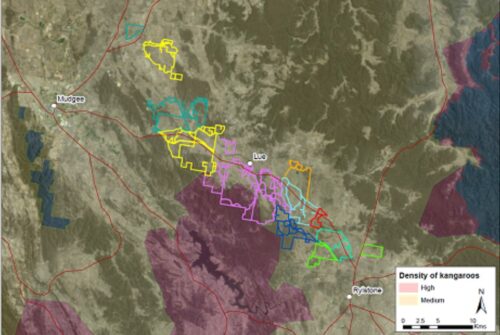
Increasing landholder collaboration for landscape-scale conservation  funded by the NSW Environmental Trust (Australia)

To develop models for incentivising on-ground collaboration on cross-property conservation and production activities.

Identify models and methods to enhance collaboration and involved the development of the online tools for dissemination of information relevant to landholders

UNSW, University of Sydney, Sydney University of Technology, NSW Environmental Trust, Landcare, Central Tableland Local Land Services

Link to the project

Understanding the social capital for facilitating the uptake of carbon farming initiatives (2018-2019)

Schermata 2020-04-23 alle 14.28.39

Project funded by the New South Wales Department of Primary Industries (Australia)

To develop and pilot a tool supporting farmers to access carbon markets, with increased knowledge of co-benefits and trade-offs. Farmers will be able to make informed decisions about entering into carbon farming by identifying cost-effective abatement activities that can be fitted into current primary industry activities..

Methodology for stakeholder needs analysis, know how to engage with farmers in the pilot area, including electronic survey and focus groups, and approaches for understanding of market segment adoption.

UNSW, University of Technology Sydney, NSW Department of Primary Industries, University of Sydney,

Link to the project

EO-derived products (2016-2019)

Schermata 2020-04-23 alle 15.42.13

Bridging science and policy in the Terrestrial Ecosystem Research Network – TERN Landscapes.  Funded by the Commonwealth National Collaborative Research Infrastructure Strategy (NCRIS) – Australia

This project demonstrates how excellence of science produced by TERN Landscapes can aid evidence-based policy.  It identifies key impact items including benefits to the community, stakeholders (users and strategic) and collaborative partnerships, and propose measures for future impact, progress and success. 

Proof of concept for a framework to monitor dynamics of wetlands and riparian zones, and mangroves.


Open access data layers on vegetation cover fraction, landcover, topography, soils and landscape.
Lessons learned on dissemination and enabling environment for mainstreaming and uptake of EO-based products by end users and public in general.

UNSW, Geoscience Australia, CSIRO, Aberystwyth University (Wales).

Link to the project

Water Information Services to Boost Irrigation Productivity.

ads_0001390973194

Australian Research Project – Linkage Grant ID: LP170100710

This project aims to develop an integrated irrigation scheduling, benchmarking and forecasting capability delivered through Rubicon’s water ordering portal that is used by most Australian irrigation farmers and many internationally. Ensuring adoption is critical and this is facilitated through integration into the existing water ordering system. 

Proof of concept for a framework to monitor dynamics of wetlands and riparian zones, and mangroves.


COALA will use the Irrigation scheduling, benchmarking and forecasting capability integrated with Rubicon’s water ordering portal.

Rubicon Water is the Industry Partner.
UoM (The University of Melbourne) is the applicant.

Link to the project

DIANA H2020 (2017 -2019)

Schermata 2020-04-23 alle 15.25.03

“Detection and Integrated Assessment of Non-authorised water Abstractions using EO”

DIANA is aimed at co-designing and openly demonstrating a commercial service platform that will empower water managers and authorities to optimise the identification and inspection of non-authorised water abstractions for irrigation as well as improve their water management policies and practices, especially in extreme conditions such as drought.


COALA will use the Irrigated area Detection, and workflow from DIANA to predict the irrigation request from each irrigation sector/district (developed by ARIES, UCLM, AGRISAT)

AGRISAT is the co-coordinator of the project and leads 2 WPs (User requirements and services definition; Services deployment and evaluation).

ARIES was involved in the project as E.O. products provider and WP leader.

WR was involved in the project as responsible for the business planning activities  and WP leader.

Link al progetto

FATIMA H2020 (2015-2018)

depositphotos_73220209-stock-photo-closeup-of-hand-planting-seeds

Farming tools for external nutrient inputs and water management

FATIMA addresses effective and efficient monitoring and management of agricultural resources to achieve optimum crop yield and quality in a sustainable environment It aims at developing innovative and new farm capacities that help the intensive farm sector optimize their external input (nutrients, water) management and use, with the vision of bridging sustainable crop production with fair economic competitiveness.


COALA will use i)data process chain, and platform (API – EODC the automatic processing of Sentinel 2 developed by BOKU); ii) Crop Nutrition status maps (NNI) developed by ARIES; iii) Soil fertility map developed by UCLM, AGRISAT (Fertimaps®) and BOKU (greensense); iv) Crop Yield map developed by UCLM, AGRISAT

UCLM was the coordinator of the project, AGRISAT is commercializing FATIMA services

ARIES was involved in the project as E.O. products provider and WP leader.

BOKU has developed on EODC the automatic processing of sentinel 2 data value-added product

Link to the project

SIRIUS FP7 (2011-2014)

Schermata 2020-04-23 alle 15.22.30

Sustainable irrigation water management and river-basin governance: Implementing user-driven services.

SIRIUS has developed new services for water managers and food producers, including maps detailing irrigation water requirements in different areas, crop water consumption estimates, yield estimates, and a range of additional information products in support of sustainable irrigation water use and management under conditions of water scarcity and drought.


Irrigation water management service developed by UCLM and ARIES; ii)Farm advisory service. developed by UCLM and ARIES

AGRISAT is a direct spin-off of SIRIUS and other similar projects 

ARIES was involved in the project as E.O. products provider and WP leader

Link to the project

IRRISAT (2011-2019)

Schermata 2020-04-23 alle 15.16.29

IRRigation advisory service based on SATellite data. EU FEASR funded Project – PSR Campania-Italy.

IRRISAT® is an innovative irrigation advisory service which to distribute the “personalised” information of crop water requirement to final users, based on EO processing. IRRISAT® operates over both large areas and small fields.


Irrisat® E.O. data process chain for operative irrigation advice provided to farmers with up to 5 days of forecast developed by ARIES

ARIES was responsible for the design and the development of all Technical activities

Link to the project